Indoor mapping by Mappire
Airport and terminal wayfinding with live flights
Give passengers one map for gates, services and connections, with their flights and tickets placed where they need to go. It opens instantly from a QR code, with no travel app to install.
- 01
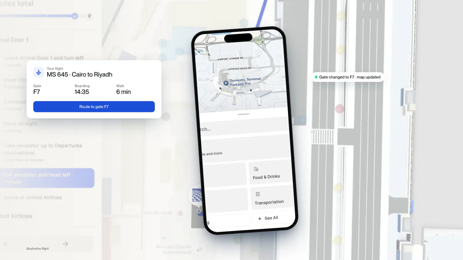
Flights, gates and tickets placed on the terminal map.
- 02
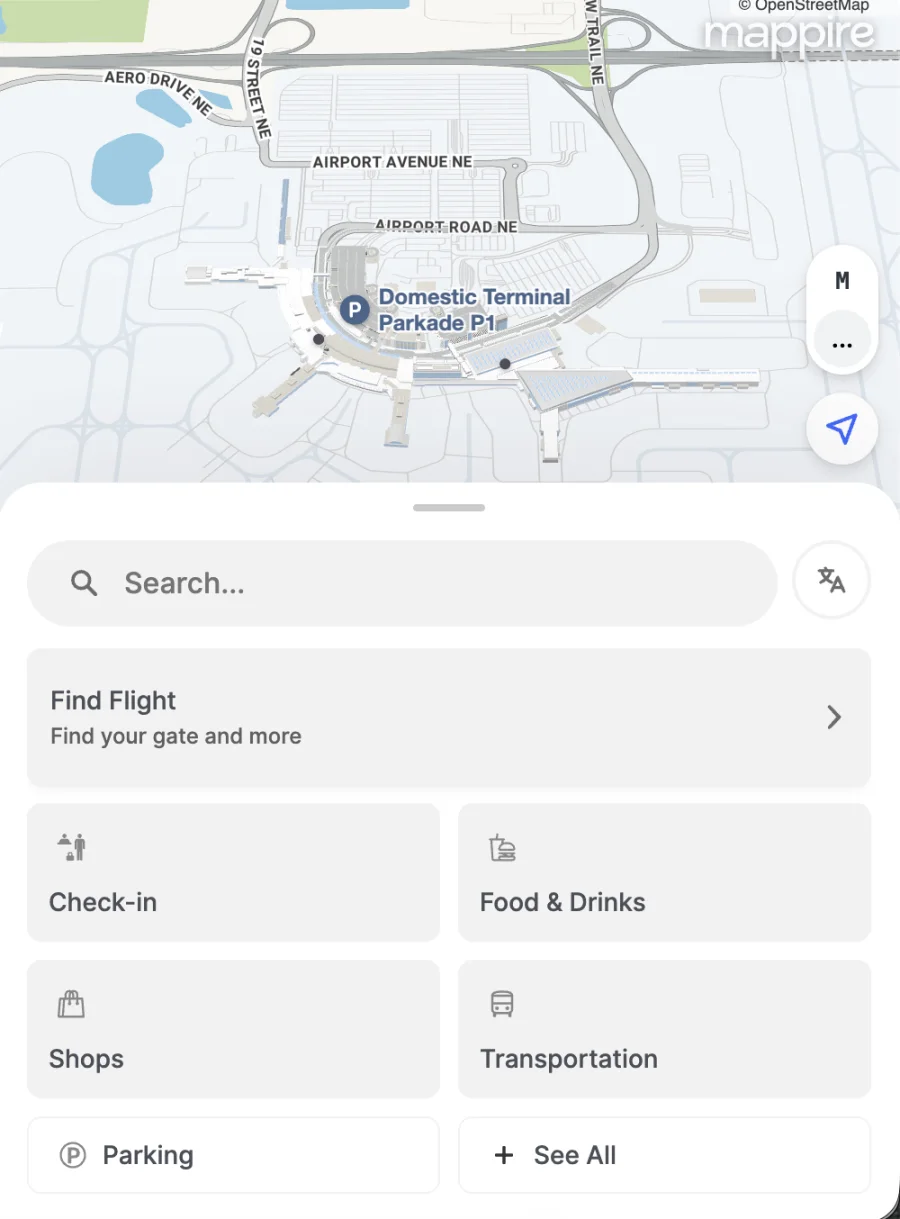
Search gates, services, lounges and connections.
- 03
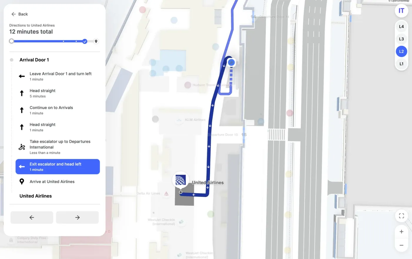
Routes across levels, zones and security.
- 04
The same map on phones, kiosks and screens.

What is an airport wayfinding system?
An airport wayfinding system guides passengers to gates, counters, security, lounges and ground transport inside a terminal. Mappire puts the terminal on a 3D map that opens instantly from a QR code or link, with each passenger’s flight and gate on it. No travel app to install.
Flights and gates on the map
A passenger sees their flight, its gate and the route to it on one screen. When a gate changes, the map follows the flight data. We connect it to your flight systems with your team.
Every step of the passenger journey
The map covers the whole terminal, across levels and through security:
- Check-in, security and gates
- Baggage claim and connections
- Lounges, food and retail
- Toilets and prayer rooms
- Parking and ground transport
A live blue dot shows passengers where they are and guides them turn by turn, with no extra hardware. The same map runs on kiosks and touchscreens in arrivals and transfer areas.
Operations behind the map
Terminal teams see busy areas and occupancy, tracked assets such as carts and service vehicles, and CCTV cameras on the same map. Closures and new routes go live for every passenger at once.
Rail, bus and ferry terminals
The same platform works for any terminal with platforms, gates or berths, in English and Arabic.
What should a terminal team check?
- A route from arrivals to a gate across levels.
- A gate change, then the public map again.
- How a passenger gets the map before arrival.
- How staff share a destination link during a disruption.
Proven with more than 30,000 users across 3 halls at HACE Expo.
Questions buyers ask
Can the airport map show flight information?
Yes. Airports get flights, tickets and their places on the map as an industry integration, so a passenger sees their gate and the route to it together.
Do passengers need to download an app?
No. The map opens instantly from a QR code, link, ticket or confirmation email in the browser.
Does it work for bus, rail and ferry terminals?
Yes. The same map, routes and integrations apply to any transport terminal with platforms, gates or berths.
Send the floor plan. We will show you what the venue can become.
Map my venue